Context
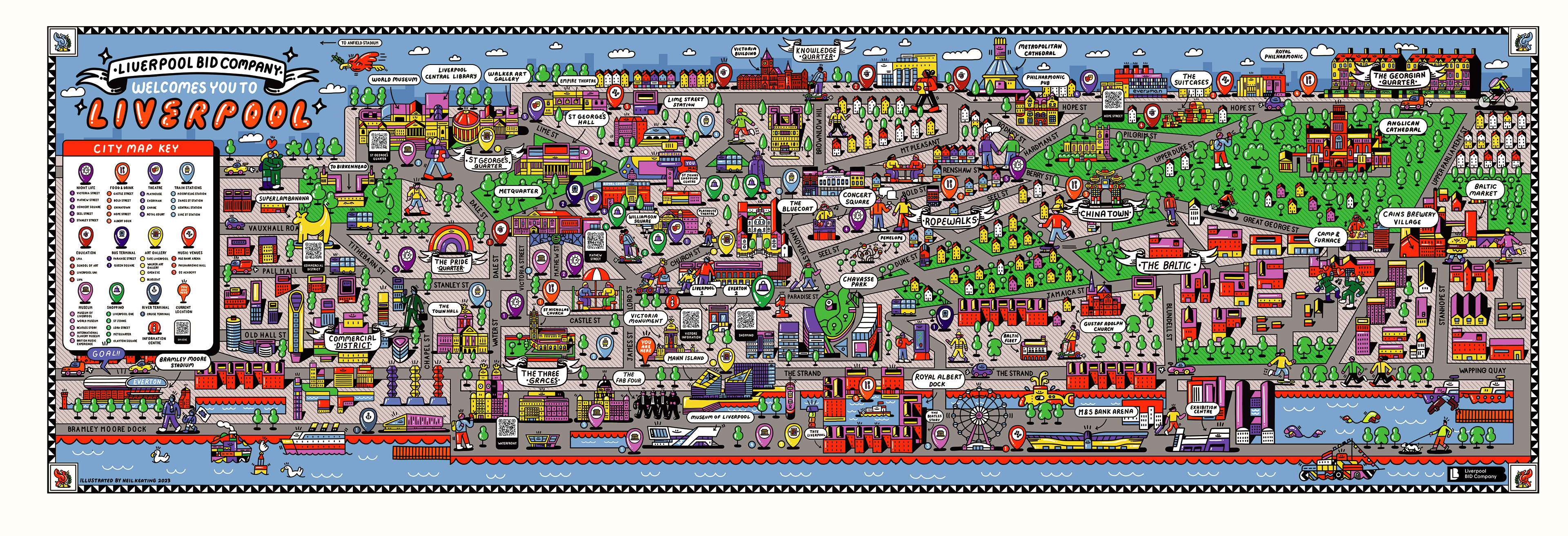
Commissioned by Liverpool BID Company, I designed an illustrated city map to welcome and guide visitors across Liverpool’s city centre.
The project formed part of a wider initiative to improve navigation, increase footfall, and encourage exploration across key districts connecting people to the city’s retail, cultural, and hospitality spaces.
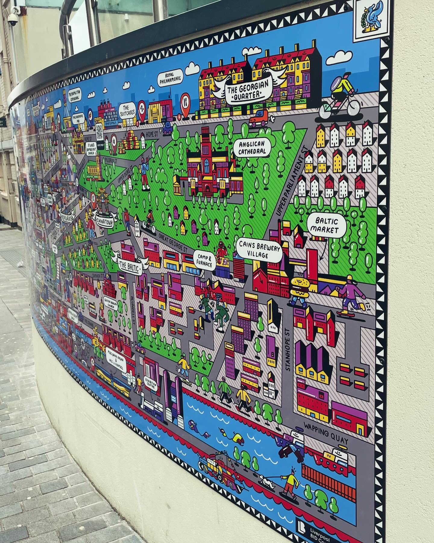
Installed across multiple locations, the map needed to function as both a practical tool and a visual representation of the city’s character.

CLOSER LOOK
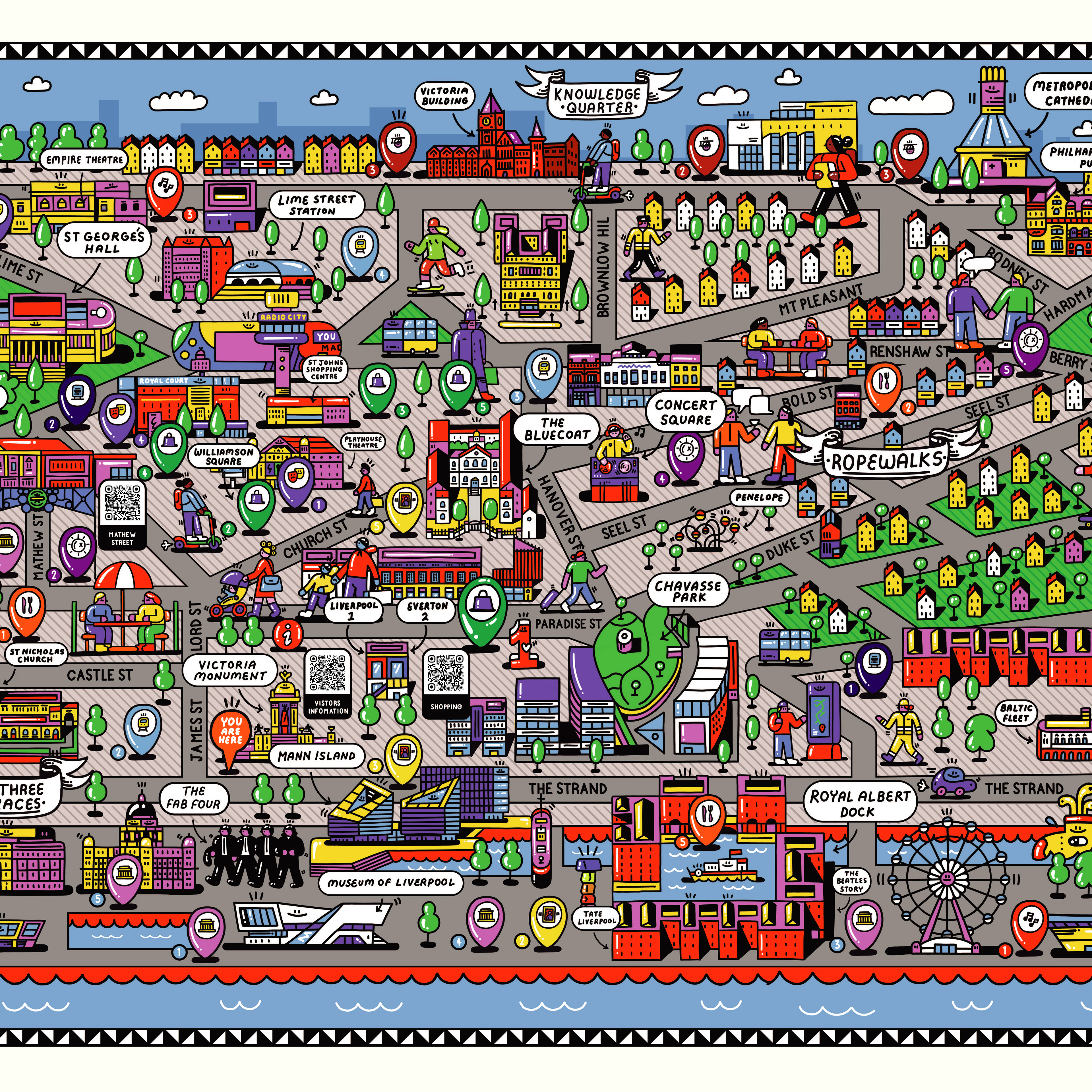
CLOSER LOOK
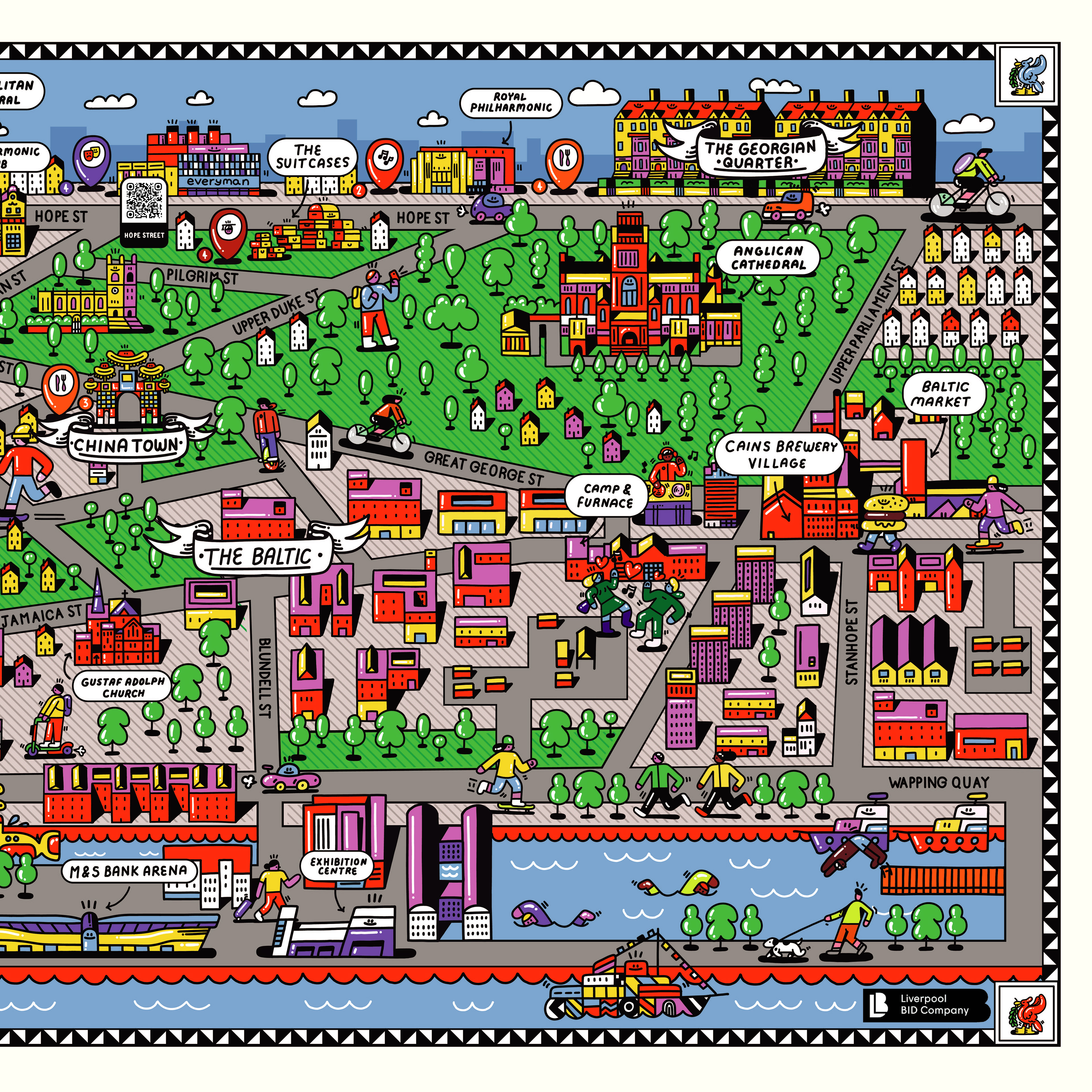
CLOSER LOOK
CREATIVE ROLE
Lead Artist & Designer
Concept and illustration of full city map
Development of wayfinding system
Translation of city landmarks into visual language
Execution
The map was designed as an engaging, illustrative wayfinder—balancing clarity with character.
Rather than a purely functional layout, the design incorporates detailed illustrations of landmarks, districts, and key destinations, allowing users to navigate the city while discovering new places within it.
The composition was structured to remain easy to read at a distance, while revealing layers of detail up close—encouraging interaction and exploration.
Digital elements, including QR integration, were incorporated to extend the experience beyond the physical map—allowing users to access further information and navigate the city in real time.

Outcome
Illustrated city map installed across Liverpool city centre
Improved wayfinding for visitors and locals
Integration of physical and digital navigation tools
Contribution to city-wide initiative to increase engagement and footfall
Impact
The project transforms wayfinding into an experience—using illustration to guide movement while reflecting the personality of the city.
By combining function with visual storytelling, the map becomes more than a navigation tool—it acts as an introduction to Liverpool itself, encouraging exploration, discovery, and connection.